Deesha APK - The Indian Grid System, GEOREF, MGRS, and UTM/UPS are all available for free, offline and off-road navigation
With Deesha, you can navigate off-road using your Android device (which has a location sensor, a GPS, GLONASS, or a BeiDou signal). The Deesha APK is completely free and offline.
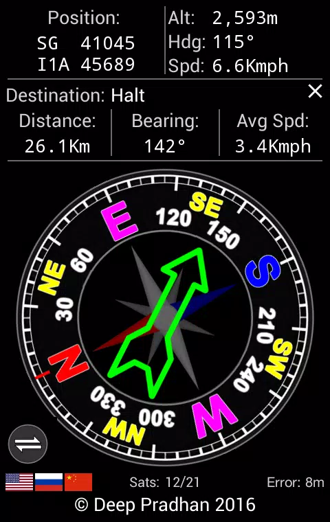
Deesha has the following major features:
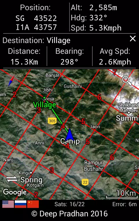
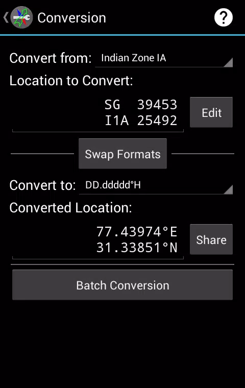
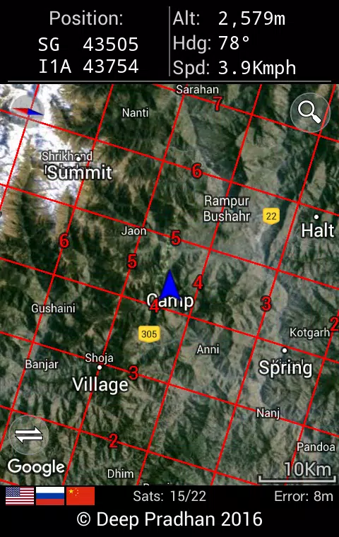
- Displays location in Indian Grid System (with support for all Zones), MGRS (Military Grid Reference System) and UTM (Universal Transverse Mercator)/UPS (Universal Polar Stereographic), GEOREF (World Geographic Reference System), and Geodetic format/Longitude and Latitude (in decimal degrees, decimal minutes, or decimal seconds).
- In the case of the Indian Grid System, the 'Indian (India, Nepal)' Datum will be used. For all other formats (i.e. Geographic, GEOREF, MGRS, and UTM), the 'WGS84 (World Geodetic System 1984)' Datum will be used.
- Navigate to shared locations, saved Waypoints, and specified locations.
- You can also display map images (PNG and JPEG format) and Google Map-based maps. Optionally, you can view a zoomed-in view of the map. You can also display device waypoints, your own position, and a grid overlay.
- Support for CSV, GPX, and KML files for exporting and importing waypoints.
- With the option to save defined areas to KML files, the area and perimeter can be calculated.
- Supported location formats can be converted between and batch conversion can be performed.
- Using Deesha, you can geotag captured photos and read any Exif location tags in JPEG files.
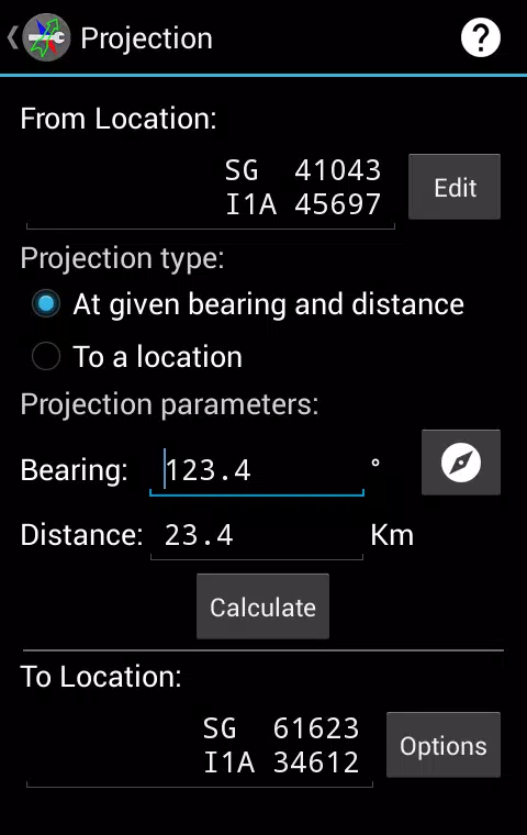
- An image projected from one location to another.
- The latest satellite information for the Global Navigation Satellite System (GNSS) and Satellite Based Augmentation System (SBAS). As well as the management of A-GPS data and high-accuracy time derived from satellites.
- For a specified location and time, Sun and Moon information is provided.
- Locations can be shared and copied - current, saved (Waypoint), converted, and projected.
- Location sharing is supported.
- A computer for tracking trips.
Important note:
- It is not dependent on the availability of an internet connection or a mobile network to compute a location. However, if a network is available, devices with A-GPS (Assisted GPS) may have a shorter time to first fix.
- Deesha APK works totally offline (without internet or mobile network access) by default - no internet or mobile network access permissions are granted.
- In order to use Google Maps, you need to install 'Deesha Internet Extension' - a Deesha App For Navigation given additional permissions only for internet usage.